Cliff vs. Brant Point: one mile, two different mornings
Two buyers, the same week
One stands at the end of Hulbert Avenue as the 6:30 boat slides past the lighthouse close enough to read the name on the bow, and decides that is the island. The other stands on Cliff Road with the Sound laid out below and the whole north shore going gold, and decides exactly the same thing.
They are barely a mile apart. On paper they are neighbors. In practice, almost all of the difference comes down to three things: elevation, walking distance, and how much ground you want around the house.
What the mile between them actually changes
Brant Point is the low, sandy hook that curls around the entrance to Nantucket Harbor, with the lighthouse at its tip — a light station established in 1746, second oldest in the country, its current tower dating to 1901. Everything there is flat and everything is close. The lanes run in a tight grid, Steamboat Wharf is minutes away on foot, and the harbor is not a view so much as the end of your street.
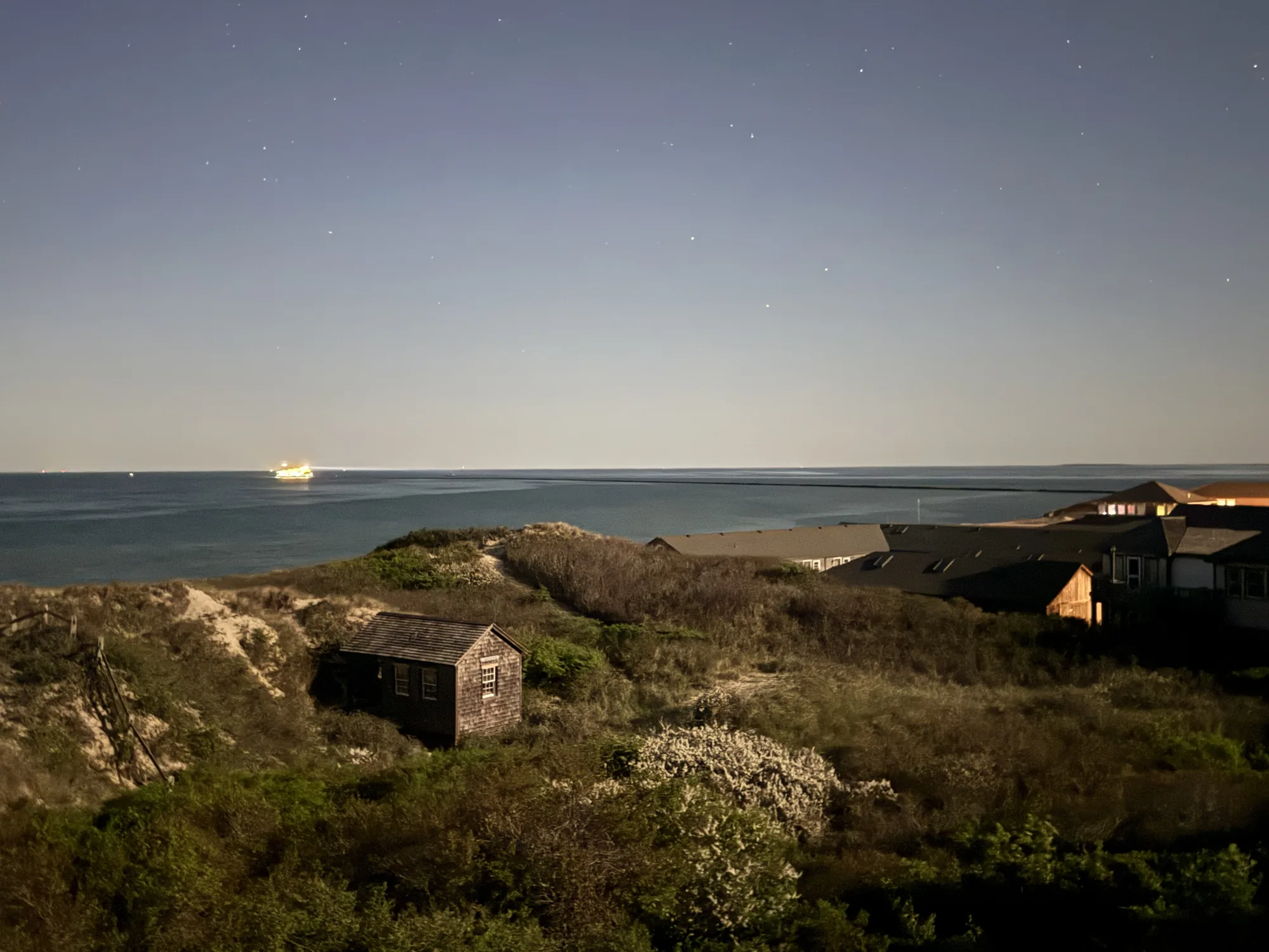
The Cliff is the bluff northwest of town, where Cliff Road runs west and the side streets step down toward Nantucket Sound. The land is higher, the parcels are larger, and the water is a horizon before it is a destination. The Town's Cliff Road sidepath — 1.56 miles, running from the Sherburne Turnpike junction out to the start of Madaket Road — tells you most of what you need to know: the Cliff is bike country. Town is entirely reachable. You just plan the trip.
That is the trade in one line. Brant Point buys proximity. The Cliff buys elevation and room.
The walk to town, and what it's really like
From most of Brant Point, Main Street is a flat walk with no hill in it. That changes daily life more than people expect. You book the 7:30 table and leave the car where it is. You walk back after dark without thinking about it. Children's Beach, at 15 Harbor View Way, sits right on the seam between the neighborhood and downtown — a small lifeguarded beach with a park, playground, picnic tables, bandstand and concession behind it.
From the Cliff, town is a genuine bike ride or a short drive rather than a stroll — and for most Cliff households, that reshapes the errand pattern rather than ruining it. Groceries go in the car. Dinner downtown is a plan. What you get back is a street with hedges instead of sidewalk traffic. Neither is better. They are different daily rhythms, and you already know which one sounds like you.
What each one does with the water
Brant Point's water is harbor water: calm, protected, and warm by island standards, with the beach running out past the lighthouse and Children's Beach on the town side. It is water you walk to in a towel.
The Cliff's water is Nantucket Sound, reached by descending. Steps Beach sits below the bluff, down the staircase off Lincoln Avenue — wide, quiet sand with no parking lot behind it. The Cliff's other water asset is the one you never have to walk to at all: north-facing frontage means the light comes across the Sound and the sun sets into it, which the harbor side simply cannot offer.
Sitting between the two is Jetties Beach at 4 Bathing Beach Road — summer lifeguards, a large parking lot, restrooms and changing rooms, a restaurant, a playground, and a roughly 380-foot seasonal boardwalk out over the soft sand. If beach infrastructure matters to you, Jetties is the reason neither neighborhood loses this round outright. More context in our Nantucket beaches guide.
The houses, and the ground they sit on
Brant Point is built out and mostly built decades ago: shingled summer houses on compact lots along a close-set grid of lanes, with the harborfront row on Hulbert Avenue and Easton Street standing apart as its own market. Lots are small enough that privacy comes from siting and shutters rather than acreage, and condition varies enormously from lane to lane. Full detail on the tiers lives on the Brant Point neighborhood page.
The Cliff is the opposite geometry. Larger parcels, mature hedging, houses set well back, and room on most lots for a pool, a guest cottage, or both. Tupancy Links — 73 acres held by the Nantucket Conservation Foundation along Cliff Road — anchors permanent open space in the middle of the neighborhood, and the Land Bank's Maxcy Pond sits further west past the water tower. The result is a streetscape that reads as landscape first, houses second. The Cliff neighborhood page breaks down the bluff-edge, estate-street and town-edge tiers.
One thing that is genuinely identical: both fall under the Historic District Commission. Nantucket's historic district covers the whole island under the Commonwealth's Acts of 1970, Chapter 395, and any exterior construction or alteration needs a Certificate of Appropriateness first. Neither neighborhood offers an easier path on design review.
What each one asks of an owner
Brant Point asks you to take elevation and flood mapping seriously. Much of the low ground there sits in mapped flood zones, which drives insurance, elevation requirements and renovation scope — the flood-zone guide covers the mechanics. It also asks you to accept close neighbors in August and limited on-street parking.
The Cliff asks for different homework: coastal bank and bluff setback rules on the water side, erosion diligence on front-tier parcels, and the ongoing cost of maintaining mature landscaping that is doing real work for your privacy. It also asks for patience — larger estate parcels turn over slowly.
Where the money sits
Both neighborhoods sit near the top of the island market, and both have a scarcity tier above the rest of the street: the harborfront row at Brant Point, and the bluff-front parcels on the Cliff. Those trade rarely, quietly, and on relationships as much as listings.
The last two years of sales put numbers on it — and they cut both ways. Across 49 single-family sales recorded in LINK between August 2024 and August 2026, the Cliff's median came in just under $7.0M over 32 trades against Brant Point's $5.8M over 17. Brant Point answered on price per square foot — roughly $2,200 to the Cliff's $1,900. Both readings describe the same market: Brant Point trades smaller houses on compact lots close to the harbor, the Cliff trades land and square footage. Neither neighborhood is "the expensive one"; they price different things.
Below that tier, the shapes differ. Brant Point's interior lanes are where a buyer gets into the neighborhood without harbor frontage, on a smaller lot, usually with renovation ahead. The Cliff's equivalent is the estate street behind Cliff Road — no bluff premium, same neighborhood character, considerably more land for the money. Two very different ways to spend a similar number. Related reading: Nantucket waterfront homes.
Summer streets, winter streets
In August, Brant Point has foot traffic — walkers heading out to the lighthouse, ferries sounding at the harbor mouth, bicycles all day. The Cliff in August is quieter by design: hedged lanes, cars rather than pedestrians, and beach traffic funneled to a few access points.
Off-season, the gap narrows and then reverses. Brant Point empties out into wind off the harbor and a lot of closed shutters, while the Cliff keeps a steady off-season pulse from dog walkers at Tupancy and the Cliff Road path.
Which one is you?
If neither quite lands, the same fork shows up elsewhere on the island — see Sconset vs. downtown, or start from the full neighborhood map.
Cliff vs. Brant Point — frequently asked questions
Can you walk to town from both?
From Brant Point, yes — Main Street is a flat walk with no hill, and most owners do it daily in season. From the Cliff, town is a bike ride or a short drive for most addresses. The Town maintains a 1.56-mile sidepath along Cliff Road, which is how most of the neighborhood gets in and out without a car.Which one has better beach access?
Different, not better. Brant Point has calm harbor water and Children's Beach, with its lifeguards, playground and bandstand, right at the town seam. The Cliff has Steps Beach below the bluff, reached by a staircase off Lincoln Avenue — far quieter, with no parking lot behind it. Jetties Beach, with parking, lifeguards, restrooms and a restaurant, sits between the two and serves both.Which has bigger lots?
The Cliff, by a wide margin. Its estate parcels carry mature landscaping and typically leave room for a pool or a guest cottage. Brant Point is a tight grid of compact lots where houses sit close together and privacy comes from siting and planting rather than acreage. That single difference drives most of what else separates the two.Which is more expensive?
Both sit at the top of the island market, and each has a scarcity tier — Brant Point's harborfront row, the Cliff's bluff-front parcels — that trades rarely and prices on its own logic. A blanket ranking is misleading; the honest comparison is tier to tier. Ask for a current side-by-side pulled from active and sold inventory.Do the same building rules apply to both?
Yes on design. Nantucket's historic district covers the entire island, so exterior work in either neighborhood needs a Certificate of Appropriateness from the Historic District Commission. The differences are environmental: flood zone elevation and insurance drive decisions at Brant Point, while bluff setbacks and coastal bank rules govern the Cliff's waterside parcels.Which is quieter in summer?
The Cliff. Its hedged lanes see far less pedestrian traffic, and beach access funnels through a few points. Brant Point is busy in August — walkers heading to the lighthouse, bicycles, and ferry traffic at the harbor mouth. Off-season the pattern shifts, with the Cliff keeping a steadier rhythm around Tupancy Links and the Cliff Road path.Stand in both before you decide — Sean will set it up
Sean Kalman is a sixth-generation Nantucketer, a Nantucket REALTOR®, and the founder of The Kalman Co., brokered by eXp Realty. He has walked buyers down both of these streets in the same afternoon, and the right answer has never once been the same twice. Reach him at sean@thekalmanco.com or 508-228-4578. Equal Housing Opportunity.